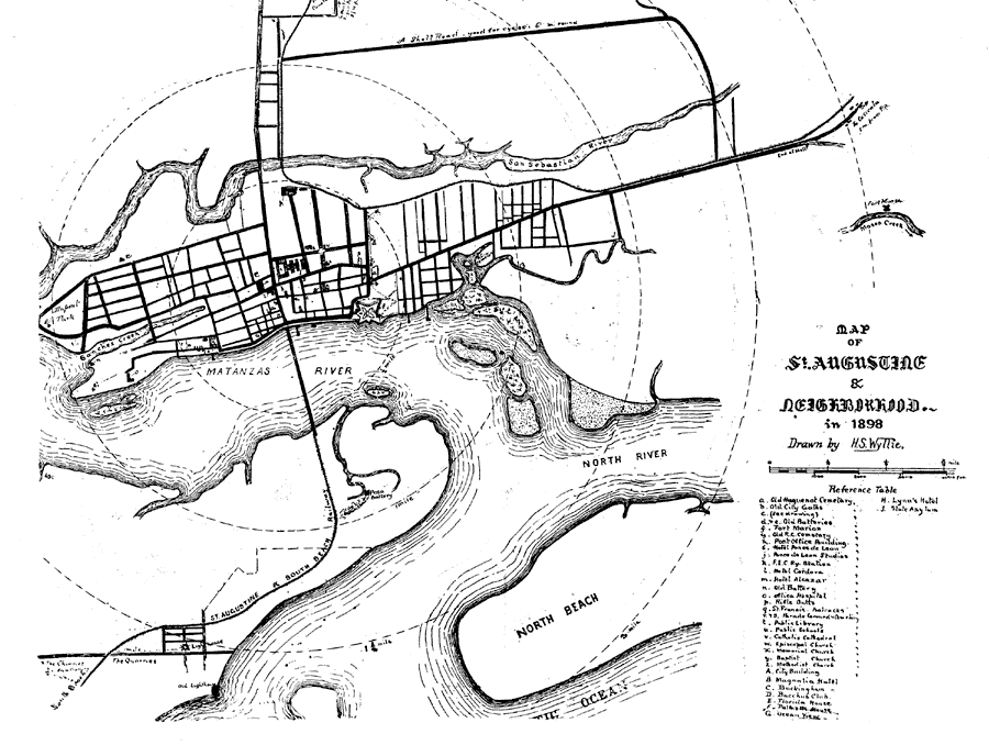
Description: Map shows the layout of St. Augustine and surrounding area in 1898 C.E. Shows local roads leading to and from the city. Shows bodies of water that surround the fort and the city. Shows the fort and lighthouse. Reference Table that tells the major buildings and areas around St. Augustine
Place Names: St. Johns, Saint Augustine, St Augustine
ISO Topic Categories: oceans, inlandWaters, transportation
Keywords: Map of St. Augustine, physical, transportation, historical, physical features, roads, oceans, inlandWaters, transportation, Unknown,1898
Source: H. S. Wyllie, St. Augustine Under Three Flags Fourth Edition (St. Augustine, FL: Record Co. , 1898) Backofbook
Map Credit: Courtesy the private collection of Roy Winkelman |
|