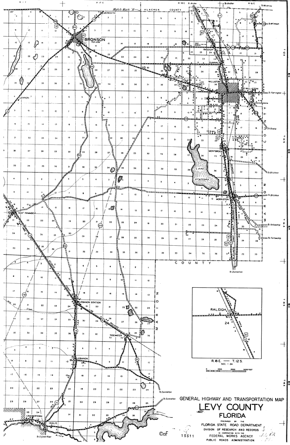
Description: This is a detailed map of the east portion of the county of Levy in the state of Florida. Section Township Range (STR) is shown. This map shows all of the main cities, state roads, railroads, US highways, businesses, tenant houses, forest ranger lookout station, cemeteries, churches, schools, camps, sawmills, townhall, factories, post offices, power plant, farm units and dwellings other than farms. Key to Florida Highway maps.
Place Names: Levy, Bronson, Lennon, Raleigh, Meredith, Gunnals, E. Williston, Montbrook, Lake Stafford, Morriston, Gulf Hammock, Lebanon, Tidewater, Crackertown, Inglis, Williston
ISO Topic Categories: boundaries, location, transportation
Keywords: Levy East, physical, political, transportation, physical features, major political subdivisions, local jurisdictions, roads, boundaries, location, transportation, Unknown,1936
Source: , Florida State Road Department (, FL: , 1936)
Map Credit: Courtesy the private collection of Roy Winkelman. |
|