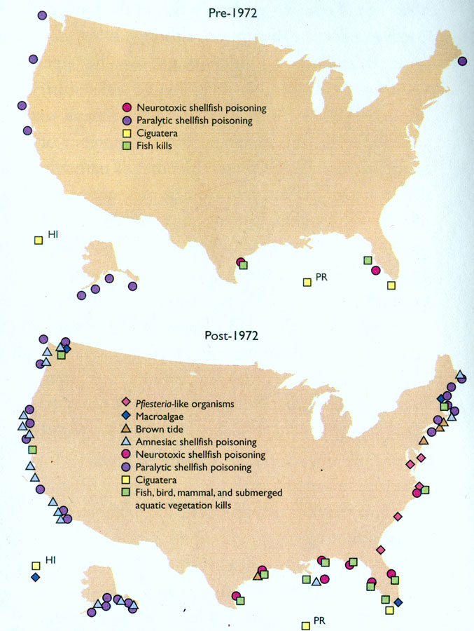
Description: Map indicates the affects of algal blooms in the waters around the U.S. from 1972 to present. Map lists such examples as Macroalgae, Ciguatera, fish kills, Paralyic shellfish poisoning, and more.
Place Names: 2000-,
ISO Topic Categories: economy, oceans, environment
Keywords: Harmful Algal Blooms, physical, statistical, hydrological, economy, oceans, environment, Unknown,1972
Source: , National Coastal Condition Report II (Washington, DC: Environmental Protection Agency, 2004) 42
Map Credit: Courtesy the private collection of Roy Winkelman |
|
