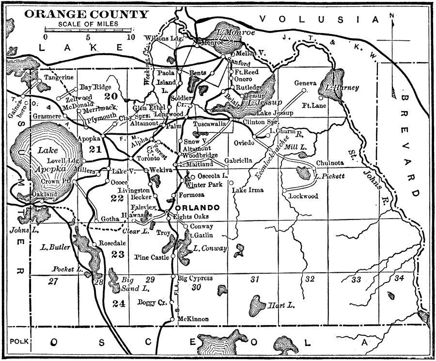
Description: A map of Orange County showing the county seat (Orlando), cities, towns, rivers, lakes, roads, and railroads present in 1890.
Place Names: Orange, Orlando, Pinecastle, Ocoee, Maitland, Zellwood , Tangerine
ISO Topic Categories: transportation, inlandWaters, boundaries
Keywords: Orange County, physical, political, transportation, physical features, county borders, railroads, roads, transportation, inlandWaters, boundaries, Unknown,1890
Source: Charles Ledyard Norton, A Handbook of Florida (New York, NY: Longmans, Green, & Co., 1890) 68
Map Credit: Courtesy the private collection of Roy Winkelman |
|