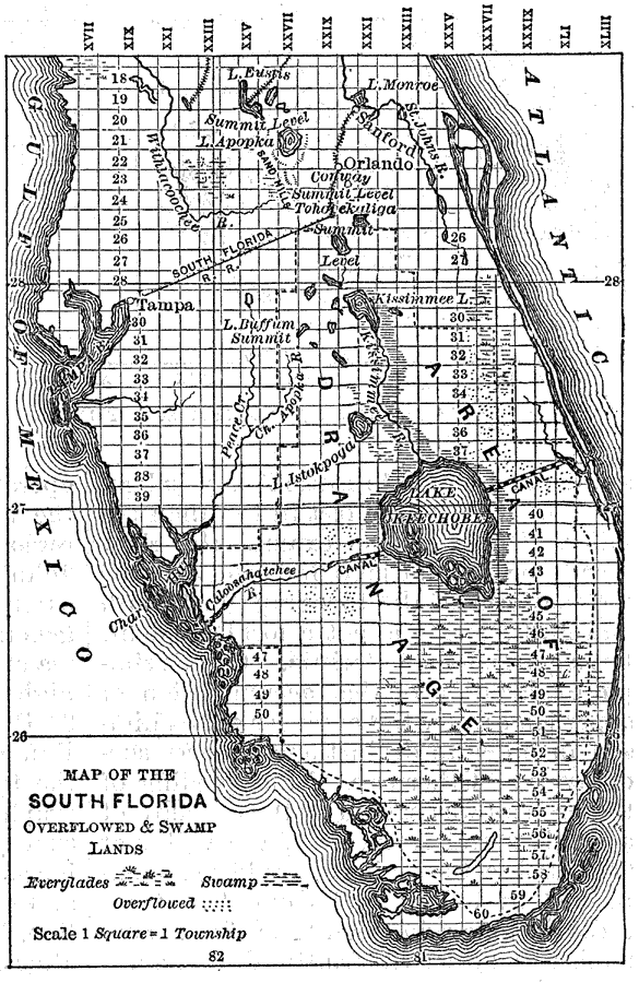
Description: Map of the southern portion of Florida dealing with the overflow of water from Lake Okeechobee. Includes railroads and a few towns pertinent to the issue, as well as the lakes and rivers. Also included are two proposed canals extending east from Lake Okeechobee to the coast and west from Lake Okeechobee to the Caloosahatche River. Shading indicates areas of swamp, the Everglades, and overflow. Northern area contains a ridge from which water flows into the Kissimmee River and south to Okeechobee. Map divided into townships and ranges based on the Tallahassee meridian and parallel.
Place Names: 1880-1899, Tampa, Orlando, Sanford
ISO Topic Categories: inlandWaters, transportation
Keywords: Map of the South Florida Overflowed & Swamp Lands, physical, political, transportation, physical features, local jurisdictions, railroads, inlandWaters, transportation, Unknown,1884
Source: Will Wallace Harney, Harper's New Monthly Magazine: Drainage of the Everglades (New York, NY: Harper & Bros., 1884) 599
Map Credit: Courtesy the Private Collection of Roy Winkelman |
|