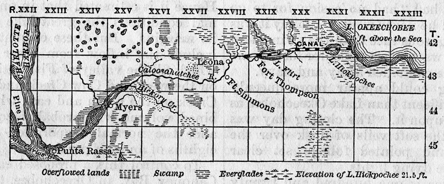
Description: Map of the Caloosahatchee River Valley. Includes a proposed canal connecting Lake Okeechobee to the Caloosahatchee River via Lake Hiokpochee, now called Hicpochee. Shading indicates areas of swamp and Everglades as well as overflowed lands. Area divided into townships and ranges based on the Tallahassee meridian and parallel.
Place Names: Charlotte, Charlotte Harbor, Myers, Fort Simmons, Fort Thompson, Lake Okeechobee, Caloosahatchee River
ISO Topic Categories: inlandWaters
Keywords: Charlotte Harbor and the Valley of the Caloosahatchee, physical, political, physical features, local jurisdictions, inlandWaters, Unknown,1884
Source: Will Wallace Harney, Harper's New Monthly Magazine: Drainage of the Everglades (New York, NY: Harper & Bros., 1884) 604
Map Credit: Courtesy the Private Collection of Roy Winkelman |
|