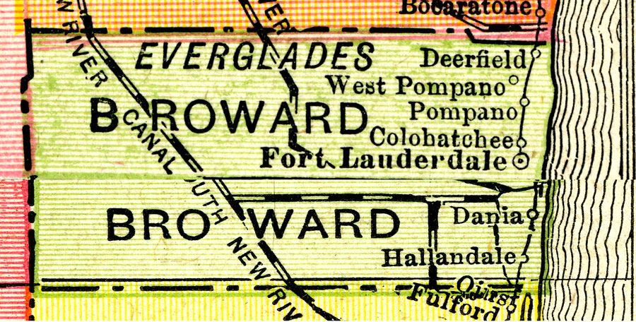
Description: A map of Broward County showing county lines, the county seat (Fort Lauderdale), railroads, and cities current to 1917.
Place Names: Broward, Ft. Lauderdale, Deerfield, Pompano , Hallandale , Dania
ISO Topic Categories: inlandWaters, boundaries, transportation, oceans
Keywords: Broward County, physical, political, transportation, physical features, county borders, railroads, inlandWaters, boundaries, transportation, oceans, Unknown,1917
Source: , New Imperial Atlas of the World (, : Rand McNally, 1917)
Map Credit: Courtesy the private collection of Roy Winkelman. |
|