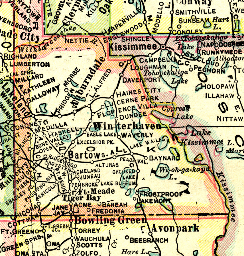
Description: This map of Polk County shows the county seat (Bartow), county boundaries, wetlands, railroads, and cities current to 1916.
Place Names: Polk, Winter Haven , Bartow, Lakeland, Lake Alfred, Auburndale, Fort Meade, Frostproof, Haines City, Davenport
ISO Topic Categories: boundaries, transportation, inlandWaters
Keywords: Polk County, physical, political, transportation, physical features, county borders, railroads, boundaries, transportation, inlandWaters, Unknown,1916
Source: , (Indianapolis, IN: National Map Company, 1916)
Map Credit: Courtesy the private collection of Roy Winkelman. |
|