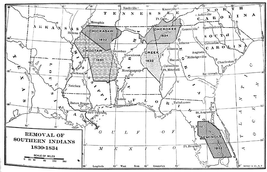
Description: A map showing the removal of southern Native Americans including the removal of the Florida Seminoles from their reservation in 1832. The removal efforts were instrumental in the lead-up to the Second Seminole War from 1835 to 1842.
Place Names: State, Saint Augustine, Fort King, Fort Brooke, Tallahassee, Pensacola, Indian land cessions, reservation, Seminole
ISO Topic Categories: boundaries, inlandWaters, oceans, society
Keywords: Removal of Southern Indians, physical, political, statistical, historical, physical features, major political subdivisions, local jurisdictions, ethnological, historical event, boundaries, inlandWaters, oceans, society, Unknown,1830 to 1834
Source: Dixon Ryan Fox, Harper's Atlas of American History (New York, NY: Harper and Brothers, 1920) 39
Map Credit: Courtesy the private collection of Roy Winkelman. |
|
