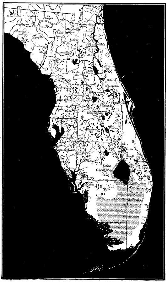
Description: Map of the Florida peninsula showing lakes, rivers, and coastline. Land colored white with water in black, making the contrast easy to see. "The southern and central portions of Florida form a great lake and swamp district, the lakes occupying sinks or depressions in the surface of the deposits overlying the limestones. Extreme irregularity of outline characterizes the shores of the lakes and extreme irregularity of direction the courses of the rivers."—Forest Physiography Isolines also provided indicating where the land exceeds 100 feet above sea level.
Place Names: 1900-1919, Orlando, Tampa, Jacksonville, Saint Augustine, Gainesville
ISO Topic Categories: boundaries, inlandWaters, elevation
Keywords: Principal Lakes and Coastal Features of Florida, physical, political, physical features, county borders, boundaries, inlandWaters, elevation, Unknown,1911
Source: Isaiah Bowman, Ph.D., Forest Physiography (New York, NY: John Wiley & Sons, 1911) 544
Map Credit: Courtesy the private collection of Roy Winkelman |
|