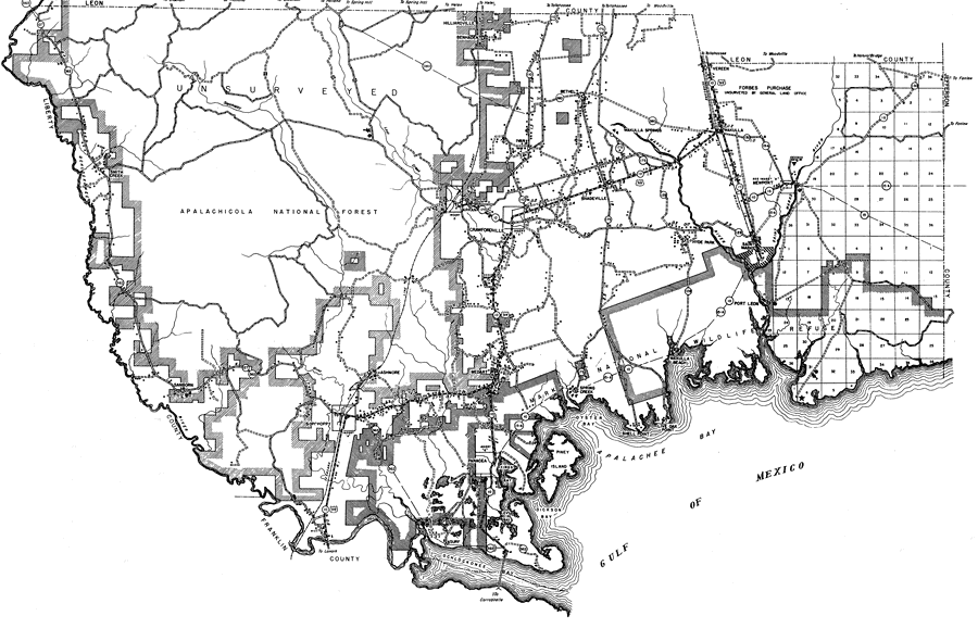
Description: This is a detailed map of the county of Wakulla in the state of Florida. Section Township Range (STR) is shown. This map shows all of the main cities, state roads, US Highways, bridge highways, drawbridge highways, federal aided highway, saw mills, railroads, inland waters, canals, ferries, corporate lines, county boundaries, county seat, airports, camps or lodges, post offices, turpentine stills, cemeteries, forest ranger lookout station, seasonal dwellings, churches, farm units, dwellings other than farms, tenant houses, businesses, townhalls, hotels, schools, hospitals and factories. Key to Florida Highway maps.
Place Names: Wakulla, Smith Creek, Hilliardville, Benhaden, Bethel, Arran, Crawfordville, Shadeville, Wakulla Springs, Vereen, Wakulla, Wakulla River, Newport, Saint Marks, Hyde Park, Wakulla Beach, Port Leon, Spring Creek, Medart, Ashmore, Sanborn, Ocklockonee River, Panacea, Surf, Kings Bay, Piney Island, Gulf of Mexico, Oyster Bay, Shell Point, Live Oak Point, Ben Haden, Sopchoppy, St. Marks, Ivan, Apalachee Bay
ISO Topic Categories: boundaries, location, transportation, inlandWaters, oceans
Keywords: Wakulla, physical, political, transportation, physical features, major political subdivisions, local jurisdictions, roads, railroads, boundaries, location, transportation, inlandWaters, oceans, Unknown,1936
Source: , Florida State Road Department (, FL: , 1936)
Map Credit: Courtesy the private collection of Roy Winkelman. |
|