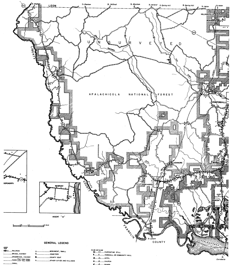
Description: This is a detailed map of the west portion of the county of Wakulla in the state of Florida. Section Township Range (STR) is shown. This map shows all of the main cities, state roads, US Highways, bridge highways, railroads, schools, camps, forest ranger lookout stations, churches, cemeteries, businesses, tenant houses, sawmills, seasonal dwellings, farm units and dwellings other than farms. Key to Florida Highway maps.
Place Names: Wakulla, Hilliardville, Benhaden, Ben Haden, Arran, Crawfordville, Medart, Ashmore, Panacea, Sopchoppy, Ochlockonee Bay, Ochlockonee River, Smith Creek, Sanborn
ISO Topic Categories: boundaries, location, transportation, inlandWaters
Keywords: West Wakulla, physical, political, transportation, physical features, major political subdivisions, local jurisdictions, roads, railroads, boundaries, location, transportation, inlandWaters, Unknown,1936
Source: , Florida State Road Department (, FL: , 1936)
Map Credit: Courtesy the private collection of Roy Winkelman. |
|