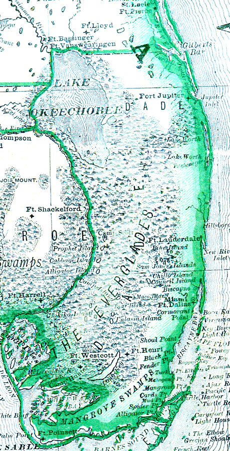
Description: This map of Dade County shows the county seat (Miami), the Everglades, forts, and cities current to 1880.
Place Names: Dade, Ft Dallas, Miami, Ft Henry, Key Biscayne, Fort Lauderdale
ISO Topic Categories: boundaries, inlandWaters
Keywords: Dade County, physical, political, swamps, wetlands, Everglades, physical features, county borders, boundaries, inlandWaters, Unknown,1880
Source: , Leslie's New World Atlas (New York, NY: Leslie-Judge Company, 1880)
Map Credit: Courtesy the private collection of Roy Winkelman. |
|