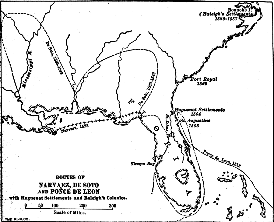
Description: A map of Florida and the southern region of North America showing the routes of the Spanish explorers Narvaez in 1528, De Soto in 1539 to 1542, and Ponce De Leon in 1513. This map also shows the early Huguenot settlements of 1564, Saint Augustine, the Saint Johns River, and Tampa Bay.
Place Names: Before 1700, Saint Augustine, Tampa Bay, Huguenot Settlements
ISO Topic Categories: inlandWaters, oceans
Keywords: Routes of Narvaez, De Soto, and Ponce De Leon, physical, historical, physical features, inlandWaters, oceans, Unknown,1513 to 1542
Source: Wilbur F. Gordy, A History of the United States for Schools (New York, New York: Charles Scribner's Sons, 1914) 17
Map Credit: Courtesy the private collection of Roy Winkelman |
|