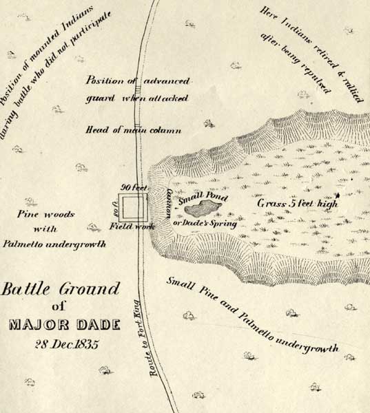
Description: This map shows the Battle Ground of Major Dade. The positions of the troops are noted. Also noted are areas of pine woods, palmetto undergrowth, and tall grass.
Place Names: State, Palatka, Pilatka, Orange Lake, Lake George, Lake Ware, Swamp of Withlacooche, Cove of Withlacooche, Micanopy, Fort Drane, Fort King, Fort Brooke, Pelaklekaha, Seminole
ISO Topic Categories: transportation, inlandWaters, society, biota
Keywords: Battle Ground of Major Dade, physical, transportation, historical, Major Dade, Dade's Battle Ground, physical features, roads, other military, transportation, inlandWaters, society, biota, Unknown,December 28, 1835
Source: J. E. Johnson, Seat of War in Florida (Philadelphia, PA: Bowen & Co., 1836)
Map Credit: Courtesy the private collection of Roy Winkelman. |
|