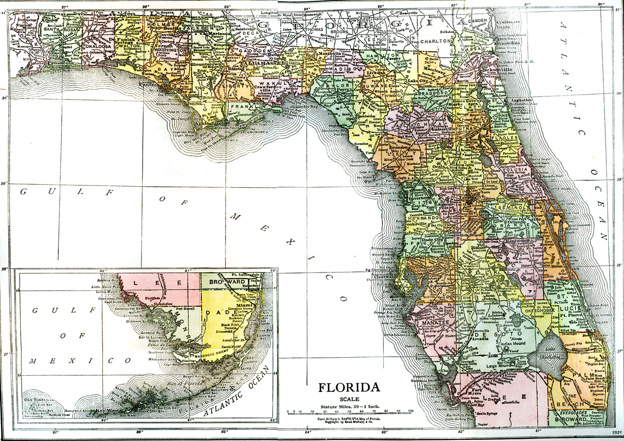
Description: A map of Florida showing major cities and county seats, waterways, and railroad lines current to 1918. Okeechobee/Everglades drainage canals are shown including the proposed West Palm Beach canal. Map scale is 1 inch equals 39 statute miles.
Place Names: 1900-1919, Cape Canaveral, Daytona Beach, Fort Lauderdale, Fort Myers, Gainesville, Jacksonville, Key West, Miami, Naples, Orlando, Panama City, Pensacola, Saint Augustine, Sarasota, St Petersburg, Tallahassee, Tampa, West Palm Beach
ISO Topic Categories: boundaries, inlandWaters, oceans, transportation
Keywords: Florida, physical, political, transportation, canals, physical features, county borders, railroads, boundaries, inlandWaters, oceans, transportation, Unknown,1918
Source: Nevin O. Winter, Florida, Land of Enchantment (Boston, MA: The Page Company, 1918) 2
Map Credit: Courtesy the University of South Florida Library |
|
