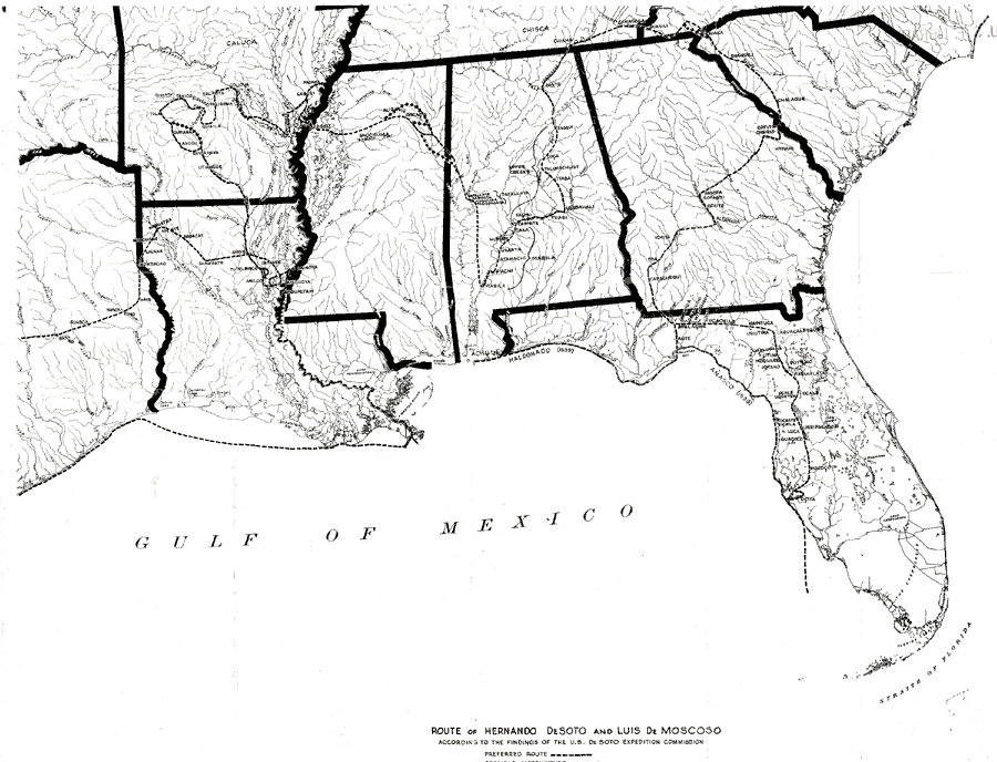
Description: A map showing the route of Hernando De Soto and Luis De Moscoso according to the findings of the U.S. De Soto Expedition Commission, 1939. Map shows Spanish place names along the route, and shows the route preferred by the commission along with possible alternative routes.
Place Names: Before 1700,
ISO Topic Categories: boundaries, �inlandWaters, �oceans
Keywords: Route of De Soto and De Moscoso, physical, �political, �historical, �transportation, physical features, major political subdivisions, water routes, historical event, boundaries, �inlandWaters, �oceans, Unknown,1539 to 1543
Source: John R. Swanton, Final Report of the US De Soto Expedition Commission (Washington, DC: Government Printing Office, 1939) Map 10
Map Credit: Courtesy the University of South Florida Library |
|