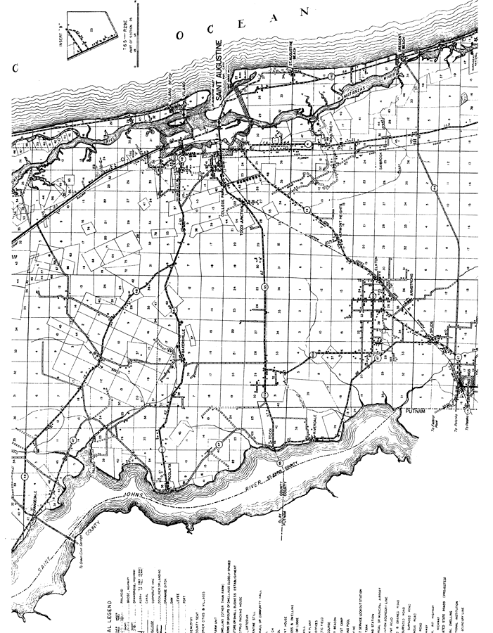
Description: This is a detailed map of the middle portion of the county of St. Johns in the state of Florida. Section Township Range (STR) is shown. This map shows all of the main cities, state roads, US highways, bridge highways, railroads, county seat, an airport, lighthouse, camps, businesses, seasonal dwellings, schools, churches, water tanks, pumping stations, hotels, turpentine stills, cemeteries, post offices, sawmills, farm units and dwellings other than farms. Key to Florida Highway maps.
Place Names: St. Johns, Orangedale, St. Johns River, Saint Johns River, Palmo, North River, Vilano Beach, Vilano, St. Augustine, Saint Augustine, College Park, Tocoi, Tocoi Junction, Bakersville, Picolata, St. Augustine Beach, Moultrie, Vermont Heights, Matanzas River, Crescent Beach, Saybrook, Riverdale, Armstrong, Spuds, Elkton, Hastings, Atlantic Ocean
ISO Topic Categories: boundaries, location, transportation, inlandWaters, oceans
Keywords: Mid St. Johns, physical, political, transportation, physical features, major political subdivisions, local jurisdictions, roads, railroads, boundaries, location, transportation, inlandWaters, oceans, Lambert_Conformal_Conic, 1936
Source: , Florida State Road Department (, FL: , 1936)
Map Credit: Courtesy the private collection of Roy Winkelman. |
|