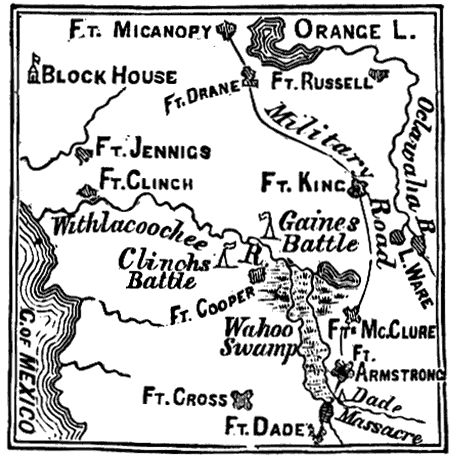
Description: A map of central peninsular Florida showing the forts and major battlefields that took place during the Second Seminole war including the Dade massacre, the attack on the Block House, Gains battle and Clinch's battle. Major rivers, lakes and wetlands are shown as well as the military road between Fort Armstrong and Fort Micanopy.
Place Names: 1820-1839, Fort Micanopy, Orange Lake,Fort Drane, Fort Russell, Fort King, Fort Jennings, Fort Clinch, Fort Cooper, Fort McClure, Fort Armstrong, Fort Cross, Fort Dade,
ISO Topic Categories: inlandWaters, society
Keywords: Seat of Seminole War, physical, transportation, historical, physical features, roads, other military, inlandWaters, society, Unknown,1835 to 1842
Source: Benson J. Lossing, An Outline History of the United States (New York, NY: Sheldon and Company, 1878) 289
Map Credit: Courtesy the private collection of Roy Winkelman |
|