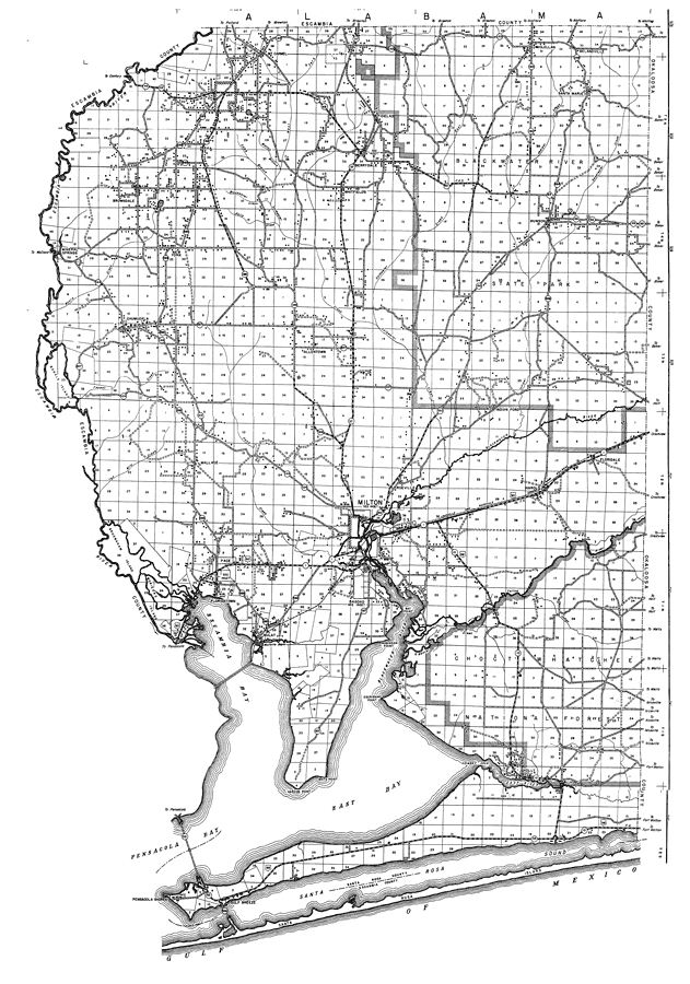
Description: This is a detailed map of the county of Santa Rosa in the state of Florida. Section Township Range (STR) is shown. This map shows all of the main cities, state roads, US Highways, bridge highways, drawbridge highways, federal aided highway, saw mills, railroads, inland waters, canals, ferries, corporate lines, county boundaries, county seat, airway beacon, airports, camps or lodges, post offices, turpentine stills, cemeteries, fire towers, seasonal dwellings, churches, farm units, dwellings other than farms, tenant houses, businesses, townhalls, hotels, schools, hospitals and factories. Key to Florida Highway maps.
Place Names: Santa Rosa, Escambia River, Browndale, Mt. Carmel, Jay, Fidelas, Berrydale, Whitfield's, McClellan, Belandville, Santa Maria, Blackwater River State Park, Blackwater River, Munson, New York, Mineral Springs, Chumuckla, Allentown, Indian Ford, Floridale, Harold, Roeville, Wallace, Bonals Island, Pace, Milton, Robinson Point, Bay Point, Escribano Point, Bagdad, Floridatown, Escambia Bay, Mulat, Garcon Point, White Point, Chimney Cove, East River, Holly, Pensacola Shores, Gulf Breeze, Santa Rosa Sound, Santa Rosa Island, Blackwater
ISO Topic Categories: boundaries, transportation, location, inlandWaters
Keywords: Santa Rosa, physical, political, transportation, physical features, major political subdivisions, local jurisdictions, roads, railroads, boundaries, transportation, location, inlandWaters, Poloconic, 1940
Source: , Florida State Road Department (, FL: , 1940)
Map Credit: Courtesy the private collection of Roy Winkelman. |
|