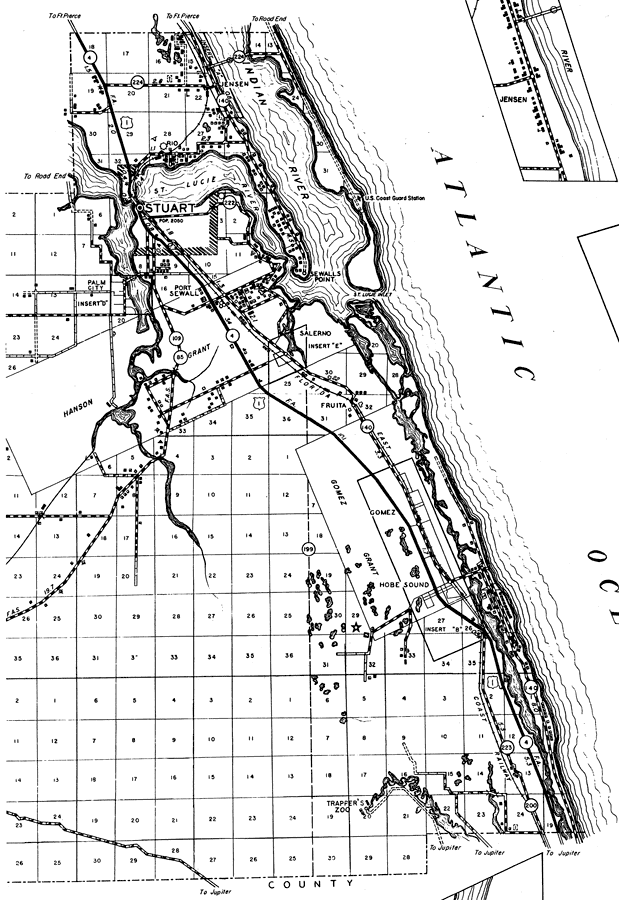
Description: This is a detailed map of the east portion of the county of Martin in the state of Florida. Section Township Range (STR) is shown. This map shows all of the main cities, state roads, US highways, railroads, canals, bridge highways, businesses, cemeteries, airports, churches, schools, camps, post offices, airway beacon, powerplant, a hotel, farm units and dwellings other than farms. Key to Florida Highway maps.
Place Names: Martin, Indian River, St. Lucie River, St. Lucie Inlet, Stuart, Port Sewall, Sewalls Point, Sewall's Point, Salerno, Palm City, Rio, Atlantic Ocean, Fruita, Gomez, Hanson Grant, Hobe Sound, Trapper's Zoo
ISO Topic Categories: boundaries, transportation, location, inlandWaters, oceans
Keywords: East Martin, physical, political, transportation, physical features, major political subdivisions, local jurisdictions, roads, water routes, railroads, boundaries, transportation, location, inlandWaters, oceans, Unknown,1936
Source: , Florida State Road Department (, FL: , 1936)
Map Credit: Courtesy the private collection of Roy Winkelman. |
|