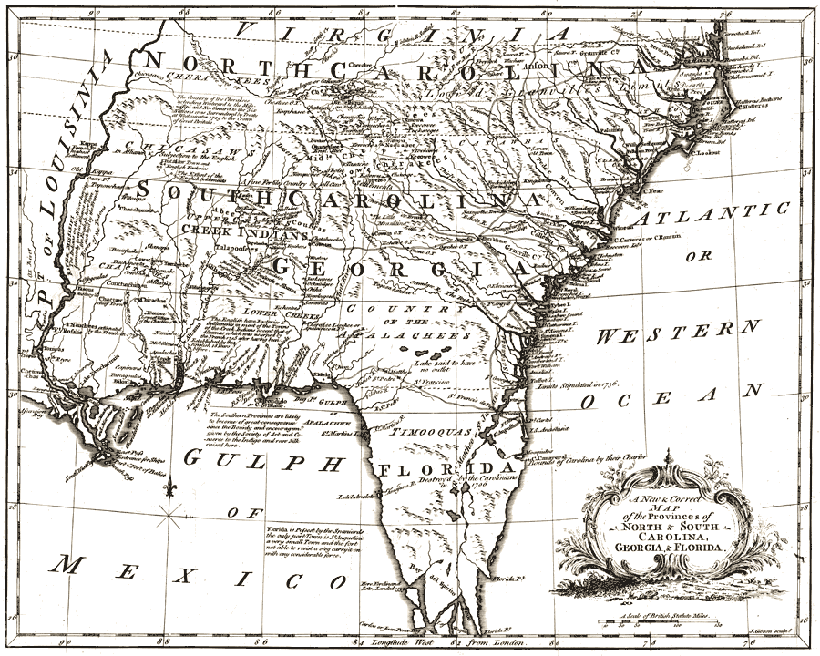
Description: Digitization provided by the USF Libraries Digitization Center. Rare Maps Collection: G3863 1762 .G53Notes from USF Library:Pictorial relief. Shows drainage, roads, etc./ In: The American gazetteer ... l762. v. 1, opp. "Carolina."Scale [ca. 1:4,700,000]Measurements.Dimensions: 26 x 34 cm."Florida is possest [sic] by the Spaniards the only port Town is St Augustine a very small Town and the fort not able to resist a sieg [sic] carryŐd on with any considerable force"The Saint Johns River is labeled as the St Mattheo or St Juan. The Atlantic Ocean is also referenced as the Western Ocean. Cape Canaveral is indicated as the southern boundary of the Carolinas by their charter, with the boundary between Florida and Georgia shown as stipulated in 1736. A road is shown running from Saint Augustine through the towns of St Francisco, St Pedro, and St Mattheo to St Marks on the Gulf of Mexico.
Place Names: 1760-1779, Cape Canaveral, Saint Augustine, Pensacola, St Marks, St Mattheo, St Francisco
ISO Topic Categories: inlandWaters, oceans, transportation
Keywords: A new and correct map of the provinces of North & South Carolina, Georgia and Florida, physical, transportation, historical, physical features, topographical, roads, inlandWaters, oceans, transportation, Unknown,1762
Source: J. (John) Gibson, (, : , 1762)
Map Credit: Courtesy of the Special Collections Department, University of South Florida. |
|