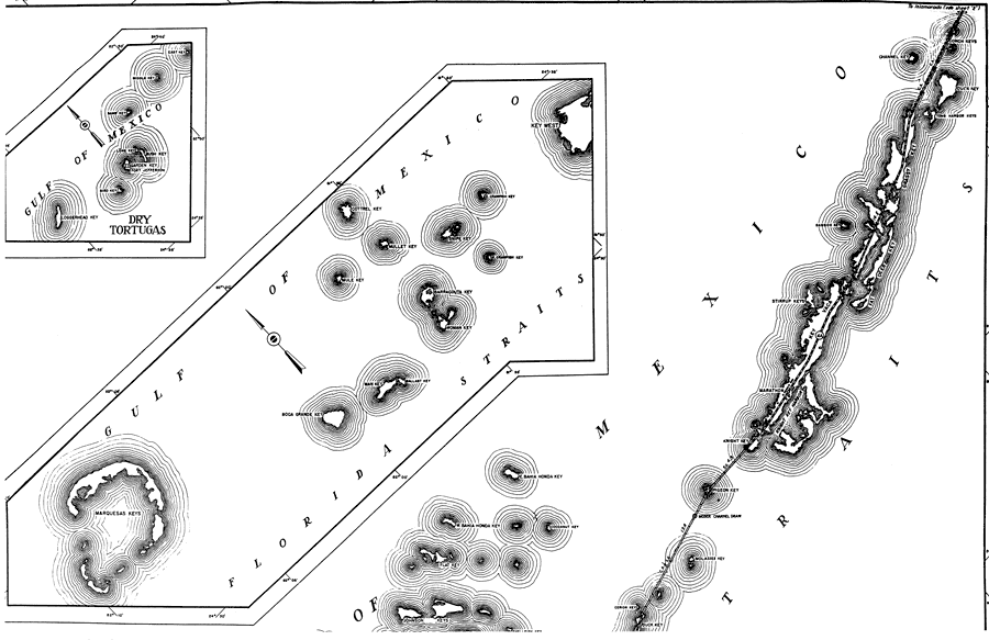
Description: This is a detailed map of the first east portion of the county of Monroe in the state of Florida. Section Township Range (STR) is shown. This map shows all of the main keys and cities, state roads, bridge highways, businesses, farm units and dwellings other than farms. Key to Florida Highway maps.
Place Names: Monroe, Gulf of Mexico, Florida Straits, Dry Tortugas, W. Crawfish Key, E. Crawfish Key, Snipe Key, Barracouta Key, Woman Key, Mullet Key, Cottrel Key, Mule Key, Ballast Key, Man Key, Boca Grande Key, Marquesas Keys, Conch Keys, Channel Key, Duck Key, Toms Harbor Keys, Grassy Key, Bamboo Key, Fat Deer Key, Key Vaca, Stirrup Keys, Marathon, Knight Key, Pigeon Key, Molasses Key, Cerion Key, Cocoanut Key, E. Bahia Honda Key, Flat Key, W. Bahia Honda Key, Johnson Keys
ISO Topic Categories: boundaries, transportation, location, inlandWaters, oceans
Keywords: East Monroe 1, physical, political, transportation, physical features, major political subdivisions, local jurisdictions, roads, boundaries, transportation, location, inlandWaters, oceans, Mercator, 1937
Source: , Florida State Road Department (, FL: , 1937)
Map Credit: Courtesy the private collection of Roy Winkelman. |
|