mapsExploring Florida
 FL Maps > State > 1720-1739 > Florida : the north part of the Gulf of Mexico with the adjacent territories belonging to Great Britain and to France, 1736
Site Map 

Florida : the north part of the Gulf of Mexico with the adjacent territories belonging to Great Britain and to France, 1736

Florida : the north part of the Gulf of Mexico with the adjacent territories belonging to Great Britain and to France.


Title: Florida : the north part of the Gulf of Mexico with the adjacent territories belonging to Great Britain and to France.
Projection: Unknown
Source Bounding Coordinates:
W: -109 E: -77 N: 40 S: 22.5

Main Map Page
Zoomify Version
B/W PDF Version
Color PDF Version
Puzzles: Easy, Medium, Hard
Google Earth
GIS Files
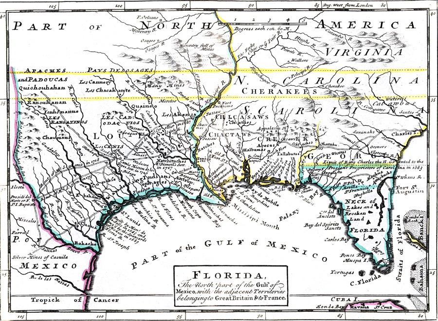
Description: Digitization provided by the USF Libraries Digitization Center. Rare Maps Collection: Notes from USF Library:Hand col. engraved map. Relief shown pictoriallyScale [ca. 1:10,250,000]; (W 109000--W 77000/N 400-- --N 22030).Measurements.Dimensions: 19 x 26 cm
Place Names: 1720-1739, Saint Augustine, Pensacola
ISO Topic Categories: boundaries, inlandWaters, oceans
Keywords: Florida : the north part of the Gulf of Mexico with the adjacent territories belonging to Great Britain and to France., physical, political, historical, physical features, topographical, country borders, major political subdivisions, boundaries, inlandWaters, oceans, Unknown,1736
Source: Herman Moll, Atlas minor ... [1736]. pl. 54 (London, : Thos. Bowles and John Bowles , 1736)
Map Credit:
SearchLicensePDF HelpGIS Help Google Earth Help Zoomify Help

 FL Maps > State > 1720-1739 > Florida : the north part of the Gulf of Mexico with the adjacent territories belonging to Great Britain and to France, 1736
Site Map