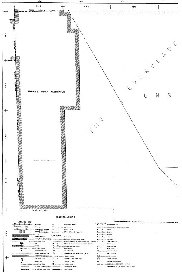
Description: This is a detailed map of the west side of the county of Broward in the state of Florida. Section Township Range (STR) is shown. This map shows all of the county boundaries, Seminole Indian Reservation, and unsurveyed land. It also shows the general legend, otherwise here is the Key to Florida Highway maps.
Place Names: Broward, Seminole Indian Reservation, Everglades
ISO Topic Categories: boundaries, location, transportation
Keywords: West Broward, physical, political, transportation, physical features, major political subdivisions, county borders, local jurisdictions, roads, boundaries, location, transportation, Unknown,1940
Source: , Florida State Road Department (, FL: , 1936)
Map Credit: Courtesy the private collection of Roy Winkelman. |
|