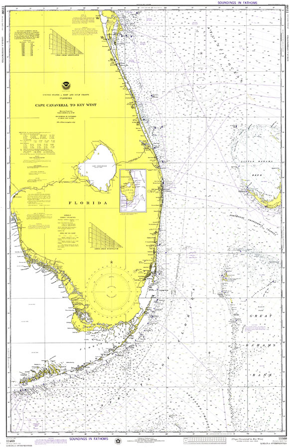
Description: A National Oceanic and Atmospheric Administration map of the coastline between Cape Canaveral and Key West current to1974. This Survey chart shows all soundings expressed in fathoms. Navigational aids such as lights, beacons, buoys and measures of magnetic declination variances are shown as well as obstructions such as shoals, submerged piles, and fixed bridges. The map scale is 1:466,940. Chart is LORAN-A overprinted. Key to NOAA maps.
Place Names: 1950-1999, Cape Canaveral, West Palm Beach, Fort Lauderdale, Miami, Key West, Fort Myers, Naples
ISO Topic Categories: transportation, inlandWaters, oceans
Keywords: Cape Canaveral to Key West, physical, hydrological, transportation, physical features, water routes, water depths, transportation, inlandWaters, oceans, Mercator, 1974
Source: National Oceanic and Atmospheric Administration, Gulf Coast Survey (Washington, DC: National Oceanic and Atmospheric Administration, 1974)
Map Credit: Courtesy the U.S. National Oceanic and Atmospheric Administration |
|