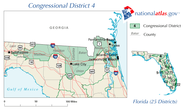
Description: This is a map of Florida's Congressional District 4 in the Congressional Districts of the United States - 107th Congress. It shows main cities, state roads, U. S. highways and county names.
Place Names: 2000-, Fernandina Beach, Yulee, Atlantic Beach, Jacksonville Beach, Lake City, Tallahassee, Jefferson, Madison, Hamilton, Columbia, Baker, Union, Nassau, Duval, Gulf of Mexico, Atlantic Ocean
ISO Topic Categories: boundaries, transportation, oceans
Keywords: 107th Congress - Florida's Congressional District 4, transportation, political, county borders, country borders, roads, boundaries, transportation, oceans, Unknown,2001
Source: , National Atlas (, : U. S. Geological Survey, 2001)
Map Credit: Courtesy of the National Atlas. |
|