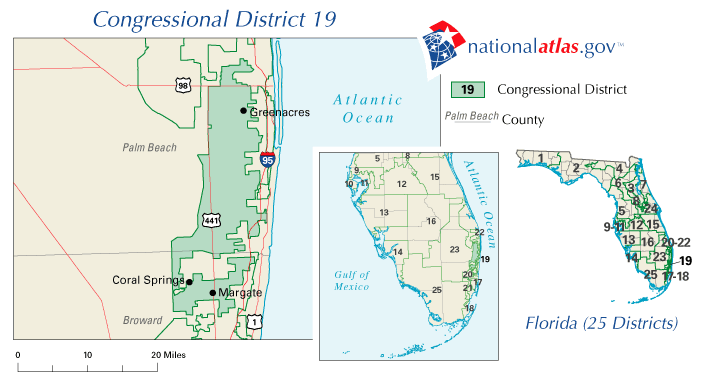
Description: This is a map of Florida's Congressional District 19 in the Congressional Districts of the United States - 107th Congress. It shows main cities, state roads, U. S. highways and county names.
Place Names: 2000-, Greenacres, Coral Springs, Margate, Atlantic Ocean, Palm Beach, Broward
ISO Topic Categories: boundaries, transportation, oceans
Keywords: 107th Congress - Florida's Congressional District 19, transportation, political, county borders, roads, boundaries, transportation, oceans, Unknown,2001
Source: , National Atlas (U. S. Geological Survey, 2001)
Map Credit: Courtesy of the National Atlas. |
|