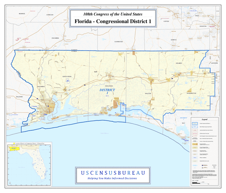
Description: This is a map of Florida's Congressional District 1 in the Congressional Districts of the United States - 108th Congress. It shows map legend, main cities, city roads, state roads, U. S. highways and county names.
Place Names: 2000-, Escambia, Bagdad, Pace, Gonzalez, Ensley, Ferry Pass, Pensacola, Brent, Bellview, Myrtle, Goulding, West Pensacola, Milton, Blackwater River, Escambia Bay, East Bay, Warrington, Gulf Breeze, Pensacola, Pensacola Bay, Santa Rosa, Century, Niceville, Destin, Valparaiso, Mary Esther, Fort Walton Beach, Wright, Okaloosa, Crestview, Laurel Hill, Paxton, De Funiak Springs, Walton, Freeport, Washington, Ebro, Vernon, Holmes, Westville, Caryville, Ponce de Leon, Chipley, Bonifay, Wausau, Gulf of Mexico
ISO Topic Categories: boundaries, transportation, oceans, inlandWaters
Keywords: 108th Congress - Florida's Congressional District 1, transportation, political, county borders, country borders, roads, boundaries, transportation, oceans, inlandWaters, Unknown,2003
Source: United States Census Bureau Geography Division, United States Census Bureau (Government Printing Office, 2003)
Map Credit: Courtesy of the United States Census Bureau. |
|
