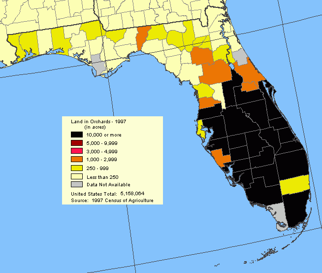
Description: This map shows "Land in Orchards" in Florida from the Agriculture Census of the United States map. This is a revised version of the April, 2000, data set.
Place Names: 2000-,
ISO Topic Categories: boundaries, economy, farming
Keywords: Land in Orchards, political, statistical, orchard, county borders, agriculture, vegetation, boundaries, economy, farming, Unknown,2000
Source: U. S. Department of Agriculture, National Atlas (U. S. Geological Survey, )
Map Credit: Courtesy of the National Atlas. |
|