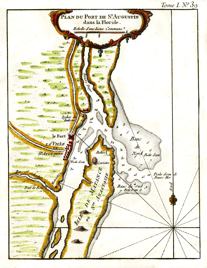
Description: Digitization provided by the USF Libraries Digitization Center. Rare Maps. This is a map of the plan of Saint Augustine and its port. Relief shown pictorially. Soundings shown in feet. Measurements.Dimensions: 21 x 16 cm. on sheet 33 x 26 cm. Measurements.Resolution: Scale ca. 1:100,000.
Place Names: St. Johns, St Augustine, Anastasia Island, Matanzas, St. Sebastian River, Atlantic Ocean, Castillo de San Marcos
ISO Topic Categories: inlandWaters, oceans
Keywords: Plan Du Port De St. Augustin dans la Floride No. 39, historical, physical, inlandWaters, oceans, Unknown,1764
Source: Jacques Nicolas Bellin, Le petit atlas maritime (Paris, : , 1764)
Map Credit: Courtesy of the Special Collections Department, University of South Florida. |
|