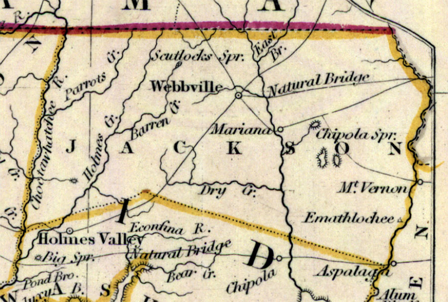
Description: Digitization provided by the USF Libraries Digitization Center. Rare Maps. This is a detail of Jackson County from a hand colored map of Florida, circa 1834. Jackson County is shown spanning across present day Holmes, Washington and Jackson counties, though Washington county is south of it on this map. This map shows cities and towns, inland waters and county borders. There are inland waters such as the Choctawhatchee River and the Econfina River. Scale [ca. 1:1,774,080].
Place Names: Jackson,
ISO Topic Categories:
Keywords: Jackson County, transportation, political, physical, county borders, railroads, Unknown,1834
Source: Henry Schenck Tanner, North America XIV, Florida (London, : Baldwin & Cradock, 1834)
Map Credit: Courtesy of the Special Collections Department, University of South Florida. |
|