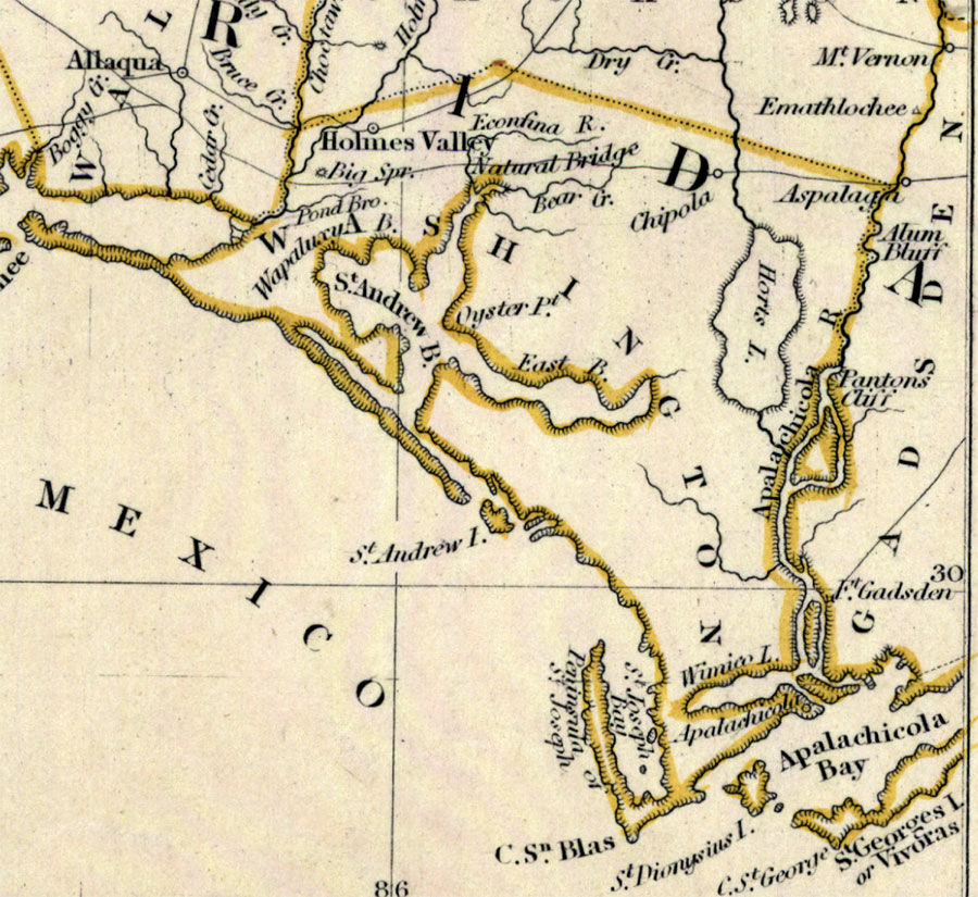
Description: Digitization provided by the USF Libraries Digitization Center. Rare Maps. This is a detail of Washington County from a hand colored map of Florida, circa 1834. Washington County is shown encompassing most of present day Bay and Gulf counties and some of Calhoun county. This map shows cities and towns, inland waters and county borders. There are inland waters such as the Apalachicola River and St. Andrew Bay. Scale [ca. 1:1,774,080].
Place Names: Washington,
ISO Topic Categories:
Keywords: Washington County, transportation, political, physical, county borders, railroads, Unknown,1834
Source: Henry Schenck Tanner, North America XIV, Florida (London, : Baldwin & Cradock, 1834)
Map Credit: Courtesy of the Special Collections Department, University of South Florida. |
|