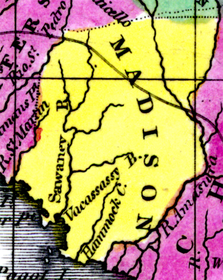
Description: Digitization provided by the USF Libraries Digitization Center. Rare Maps. This is a detail map of Madison county circa 1834. It shows Alligator Pt. and inland waters including the Suwannee (Sawaney) River.
Place Names: Madison, Pagot Island, Alligator Pt., Sawaney River, Suwannee River, Vacassassy River, Gulf of Mexico
ISO Topic Categories: inlandWaters, boundaries, oceans
Keywords: Madison County, physical, historical, political, physical features, county borders, inlandWaters, boundaries, oceans, Unknown,1834 AD
Source: William Darby, Memoir on the geography and natural and civil history of Florida (Philadelphia, PA: Thomas H. Palmer, 1834)
Map Credit: Courtesy of the Special Collections Department, University of South Florida. |
|