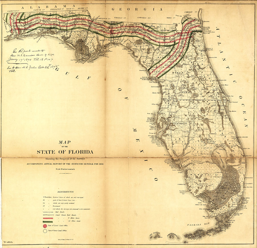
Description: Railroad map of Florida showing drainage, cities and towns, roads, railroads, location of the land grant railroads and indicating the 6- and 15-mile limits of grants in 1859. Township grids based on the Tallahassee basis parallel and the Tallahassee prime meridian shows the extent of land survey in Florida and the fact that much of the Everglades and the Forbes Purchase or Forbes Grant in northern Florida were not surveyed in 1859. Land office locations are given. The map scale is 1:1,140,480. Manuscript annotation found on map reads: "See Report made to Hon. W. S. Herndon House of Reps. Jany. 17, 1874 Vol 13. p. 147--See to Hon. D. S. Yulu Oct 22nd, 1875."
Place Names: 1840-1859, Cape Canaveral, Daytona Beach, Fort Lauderdale, Fort Myers, Gainesville, Jacksonville, Key West, Saint Augustine, Tallahassee, Tampa
ISO Topic Categories: transportation, inlandWaters, boundaries
Keywords: Map of the State of Florida showing the progress of the surveys accompanying annual report of the Surveyor General, physical, political, transportation, physical features, county borders, railroads, roads, transportation, inlandWaters, boundaries, Unknown,1859
Source: , Annual Report of the Surveyor General (New York, NY: General Land Office, 1859)
Map Credit: Courtesy of the Geography and Map Division of the Library of Congress. |
|