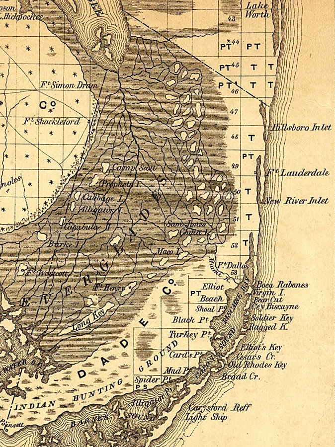
Description: Railroad map of Dade County, Florida showing river drainage, several U.S. forts, and the Everglades are shown as well as an area at the south end of the county designated as Indian hunting ground. Township grids based on the Tallahassee basis parallel and the Tallahassee prime meridian shows the extent of land survey in Florida along the coast in 1859 and the unsurveyed area of the Everglades. The map scale is 1:1,140,480.
Place Names: Dade, Fort Lauderdale, Fort Dallas, Boca Rabons, Hillsborough Inlet, Ft Dallas
ISO Topic Categories: transportation, inlandWaters, boundaries
Keywords: Dade County, physical, political, transportation, physical features, county borders, railroads, roads, transportation, inlandWaters, boundaries, Unknown,1859
Source: , Annual Report of the Surveyor General for 1859 (New York, NY: General Land Office, 1859)
Map Credit: Courtesy of the Geography and Map Division of the Library of Congress. |
|