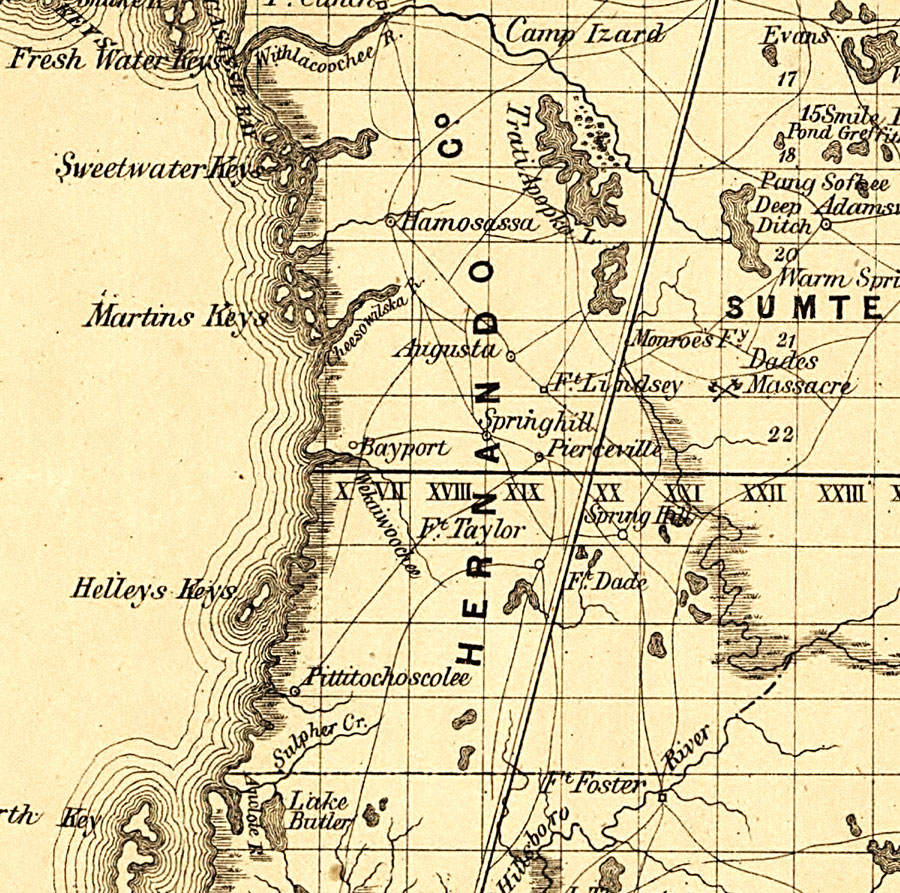
Description: Railroad map of Hernando County, Florida showing river drainage, cities and towns, roads, and railroads in 1859. Several U.S. Forts are shown as well as the site of Major DadeŐs Massacre (1835- Second Seminole War). Township grids based on the Tallahassee basis parallel and the Tallahassee prime meridian shows the extent of land survey in Florida. The map scale is 1:1,140,480.
Place Names: Hernando, Spring Hill, Bayport
ISO Topic Categories: transportation, inlandWaters, boundaries
Keywords: Hernando County, physical, political, transportation, physical features, county borders, railroads, roads, transportation, inlandWaters, boundaries, Unknown,1859
Source: , Annual Report of the Surveyor General for 1859 (New York, NY: General Land Office, 1859)
Map Credit: Courtesy of the Geography and Map Division of the Library of Congress. |
|