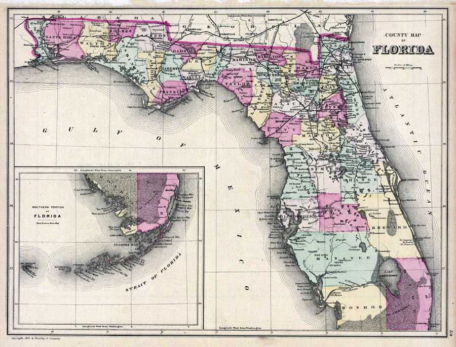
Description: Digitization provided by the USF Libraries Digitization Center. Rare Maps. This is a hand colored map of Florida showing the counties, cities and towns, inland waters, railroads, etc, circa 1882. There is also an inset map titled "Southern Portion of Florida." Measurements.Dimensions: 28 x 37 cm. Measurements.Resolution: Scale [ca. 1:2,217,600].
Place Names: 1880-1899, Cape Canaveral, Fort Lauderdale, Tampa, Saint Augustine, Tallahassee, Jacksonville, Sarasota, St. Johns River, Gulf of Mexico, Atlantic Ocean, Miami, Orlando, Gainesville, Pensacola, Key West, Fort Myers, Daytona Beach
ISO Topic Categories: inlandWaters, boundaries, transportation, oceans
Keywords: County Map of Florida, physical, historical, political, transportation, physical features, county borders, country borders, railroads, inlandWaters, boundaries, transportation, oceans, Unknown,1882
Source: , (Philadelphia, PA: Wm. M. Bradley & Bros., 1882)
Map Credit: Courtesy of the Special Collections Department, University of South Florida. |
|