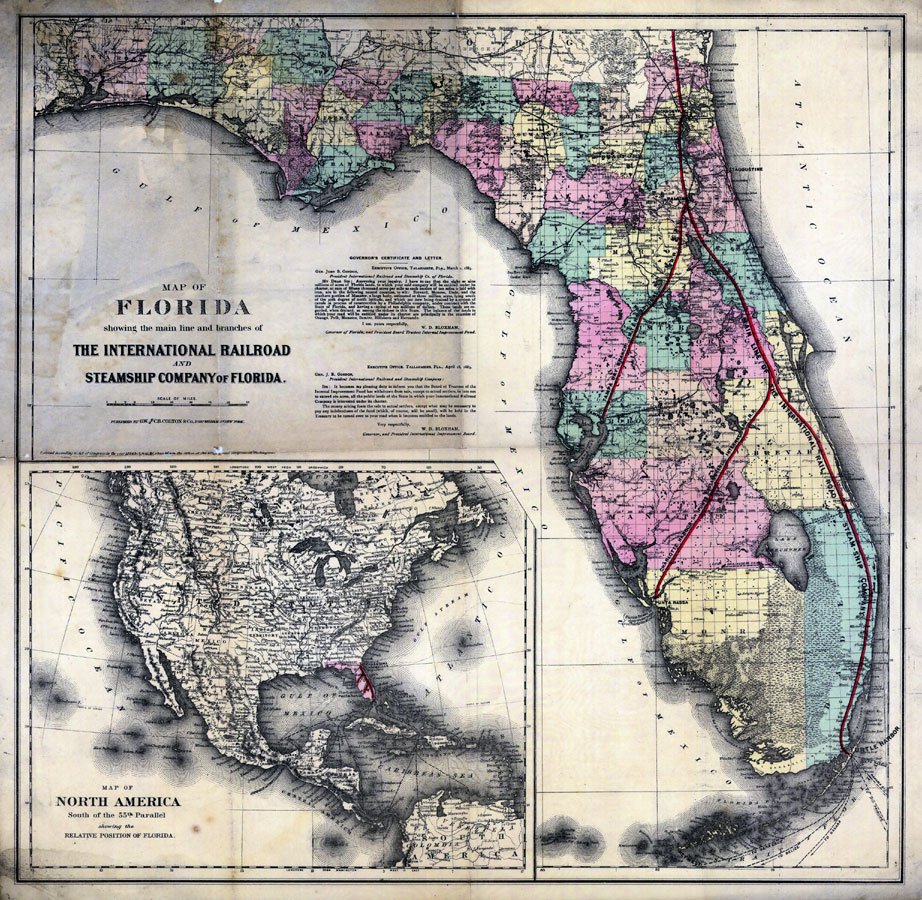
Description: Digitization provided by the USF Libraries Digitization Center. Rare Maps. This is a map of the state of Florida showing the main line and branches of the International Railroad and Steamship Company of Florida circa 1885. It also shows counties, cities and towns, and inland waters. Section Township Range (STR) is shown. Relief on inset shown by hachures. Includes grid, and 2 letters by W. D. Bloxham, governor of Florida, to Gen. J.B. Gordon, president of the International Railroad and Steamship Company. Inset map of North America south of the 55th parallel, showing the relative position of Florida.Measurements.Dimensions: 50 x 50 cm. Measurements.Resolution: Scale [ca. 1:1,488,960]
Place Names: 1880-1899, Tallahassee, Jacksonville, Saint Augustine, Gainesville, Daytona Beach, Cape Canaveral, Tampa, Miami, Key West, Sarasota, Gulf of Mexico, Atlantic Ocean, Pensacola, Fort Myers
ISO Topic Categories: transportation, boundaries, inlandWaters, oceans
Keywords: Map of Florida showing the main line and branches of the International Railroad and Steamship Company of Florida, historical, transportation, political, physical, county borders, country borders, railroads, transportation, boundaries, inlandWaters, oceans, Unknown,1884
Source: William Dunnington Bloxham, (New York, NY: G.W. & C.B. Colton & Co.; International Railroad and Steamship Company of Florida (IRSC), 1884)
Map Credit: Courtesy of the Special Collections Department, University of South Florida. |
|