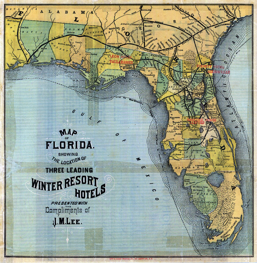
Description: Digitization provided by the USF Libraries Digitization Center. Rare Maps. This is a map of Florida showing the location of three leading winter resorts circa 1885. They are in Sanford, Jacksonville and Tallahassee. "Presented with the compliments of J.M. Lee." From a brochure advertising the Sanford House in Sanford, Florida. Brochure in pocket attached to map. Measurements.Dimensions: 28 x 28 cm., on sheet 30 x 29 cm.
Place Names: 1880-1899, Tampa, St. Petersburg, Fort Myers, Bartow, Bradenton, Gulf of Mexico, Orlando, Daytona Beach, Cape Canaveral, Saint Augustine, Pensacola, Tallahassee, Sanford, Jacksonville, Gainesville
ISO Topic Categories: transportation, boundaries, inlandWaters, oceans
Keywords: Map of Florida: 3 leading winter resort hotels, historical, transportation, political, county borders, country borders, railroads, transportation, boundaries, inlandWaters, oceans, Unknown,1885
Source: , (New York, NY: Leve & Alden Printing Co., 1885)
Map Credit: Courtesy of the Special Collections Department, University of South Florida. |
|