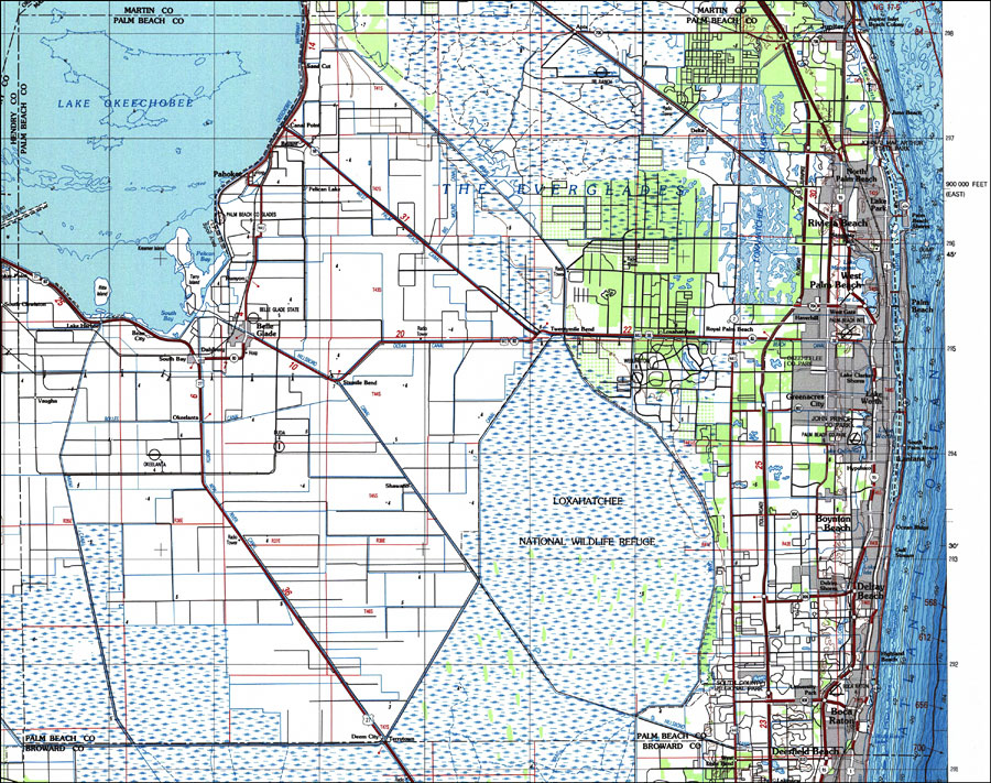
Description: A US Geological Survey and National Ocean Service map of Palm Beach County in south Florida current to 1987. This topographic-bathymetric map shows elevations and depths in meters. Contour interval 5 meters. Bathymetric contour interval 10 meters. Map also includes roads, waterways, airports, national parks and refuges, swamps, and forests. Map divided into townships and ranges. North American 1929 Datum used. The map scale is 1:250,000, metric . Key to USGS maps.
Place Names: Palm Beach, Jupiter, Juno Beach, Palm Beach, West Palm Beach, Lake Worth, Loxahatchee, Boynton Beach, Delray Beach, Boca Raton, Belle Glade, Pahokee
ISO Topic Categories: transportation, inlandWaters, oceans, elevation
Keywords: Palm Beach County, Florida, physical, political, transportation, hydrological, physical features, topographical, county borders, roads, railroads, water routes, water depths, transportation, inlandWaters, oceans, elevation, Unknown,1987
Source: US Geological Survey and National Ocean Service, West Palm Beach to Naples (Reston, VA: US Geological Survey, 1987)
Map Credit: Courtesy the U.S. National Oceanic and Atmospheric Administration |
|