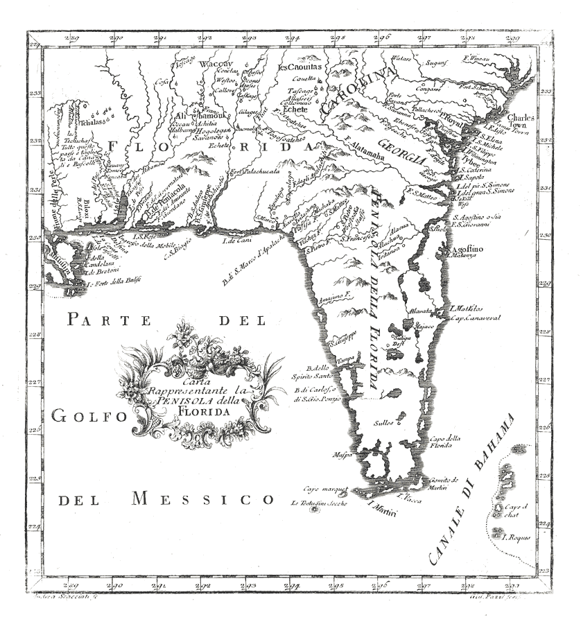
Description: Digitization provided by the USF Libraries Digitization Center. Rare Maps. This is a map of Florida from Italy, circa 1763. It also includes part of the southeast U. S. including South Carolina and Georgia. It shows cities, towns and inland waters. Measurements.Dimensions: 23 x 25 cm. Measurements.Resolution: Scale ca. 1:6,000,000
Place Names: 1760-1779, Gulf of Mexico, Atlantic Ocean, Pensacola, Saint Augustine, South Carolina, Georgia, Tampa, Cape Canaveral, Cape Florida
ISO Topic Categories: inlandWaters, oceans
Keywords: Carta Rappresentante la Penisola della Florida, historical, physical, physical features, inlandWaters, oceans, Unknown,1763
Source: Andrea Scacciati and Giuseppe Pazzi, Il Gazzettiere Americano, v. 1 (Livorno, Italy, : Marco Coltellini, 1763) 191
Map Credit: Courtesy of the Special Collections Department, University of South Florida. |
|