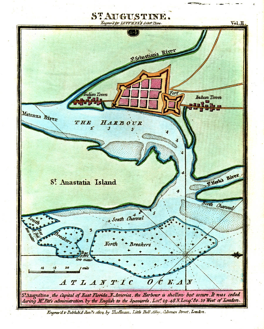
Description: Digitization provided by the USF Libraries Digitization Center. Rare Maps. This is a map of St. Augustine which was the capital of East Florida, circa 1802. This map shows roads, Indian towns, the fort (San Marcos), inland waters and water depths. The map states, "St. Augustine, the Capital of East Florida, N. America, the Harbour is shallow but secure. It was ceded during Mr. Pitt's administration by the English to the Spaniards." Measurements.Dimensions: 14.5 x 18 cm. Measurements.Resolution: Scale [ca. 1:31,700]
Place Names: St. Johns, St. Sebastians River, Castillo de San Marcos, Matanza River, Matanzas River, Anastasia Island, St. Augustine, Saint Augustine, St. Marks River, Atlantic Ocean, East Florida
ISO Topic Categories: inlandWaters, transportation, location, oceans
Keywords: St. Augustine Engraved for Luffman's Select Plans, historical, transportation, physical, hydrological, physical features, roads, water routes, water depths, inlandWaters, transportation, location, oceans, Unknown,1802 AD
Source: J. Luffman, (London, : J. Luffman, 1802)
Map Credit: Courtesy of the Special Collections Department, University of South Florida. |
|