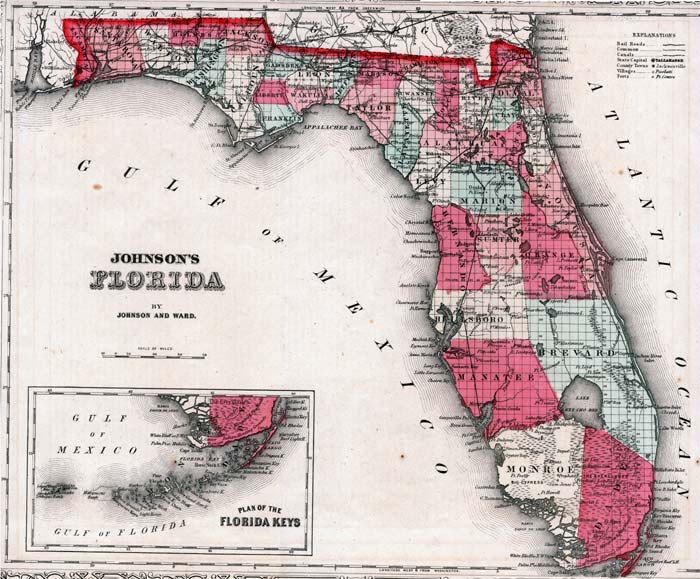
Description: This is a map of Johnson's Florida, circa 1860. It shows counties in color, towns, villages, county seats such as Ocala, forts such as Ft. Harrison, railroads, common roads, canals, state capital at Tallahassee, inland waters such as the St. Johns River, oceans and Section Township Range (STR). There is also an inset map showing the plan of the Florida Keys.
Place Names: 1860-1879, Tampa, Tallahassee, Gainesville, Jacksonville, Key West, Miami, Cape Canaveral, Saint Augustine, Sarasota, Fort Myers, Fort Lauderdale, Pensacola, Gulf of Mexico, Atlantic Ocean
ISO Topic Categories: boundaries, inlandWaters, oceans, transportation
Keywords: Johnson's Florida, physical, political, historical, transportation, physical features, county borders, railroads, roads, water routes, boundaries, inlandWaters, oceans, transportation, Unknown,1860
Source: Johnson, A.J., Johnson's New Illustrated Family Atlas (New York, NY: Johnson and Browning, 1860) 40
Map Credit: Courtesy the private collection of Roy Winkelman. |
|