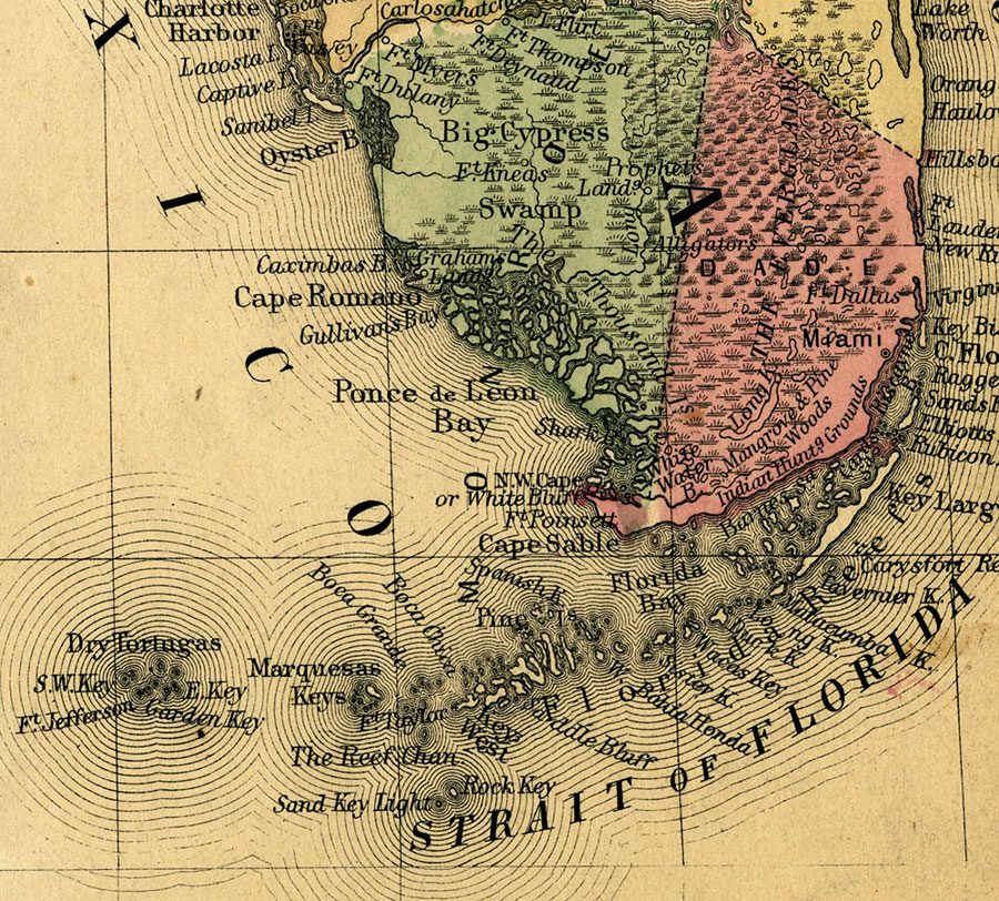
Description: A map of Monroe County as of 1860 showing towns, bodies of water, and the Big Cypress Swamp.
Place Names: Monroe, Key West, Key Largo, Big Cypress Swamp, Prophets Land, Grahams Land
ISO Topic Categories: boundaries, biota, inlandWaters, oceans
Keywords: Monroe County, physical, political, swamps, wetlands, physical features, county borders, boundaries, biota, inlandWaters, oceans, Unknown,1860
Source: Augustus Mitchell, Mitchell's New General Atlas (Philadelphia, PA: S. Augustus Mitchell, 1860)
Map Credit: Courtesy the private collection of Roy Winkelman. |
|