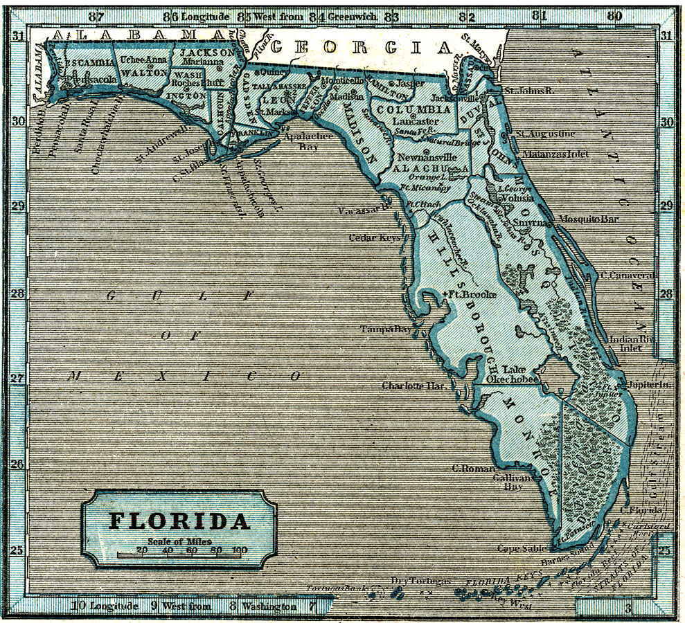
Description: A map of Florida as of 1845 showing wetlands, rivers, lakes, forts, towns, and the state capital, Tallahassee.
Place Names: 1840-1859, Tallahassee, Pensacola, Saint Augustine, Jacksonville, Everglades, Lake Okeechobee
ISO Topic Categories: biota, boundaries, planningCadastre, inlandWaters
Keywords: Florida, physical, political, wetlands, swamps, Everglades, physical features, major political subdivisions, county borders, biota, boundaries, planningCadastre, inlandWaters, Unknown,1845
Source: Sidney Edwards Morse, A system of Geography, for the use of schools (New York, NY: Harper & Brothers, 1845)
Map Credit: Courtesy the private collection of Roy Winkelman. |
|