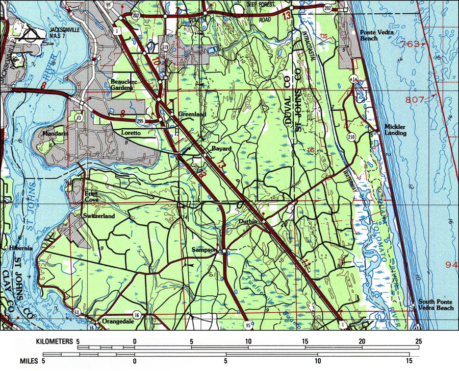
Description: A US Geological Survey and National Ocean Service map of St. Johns County, current to 1988. The map shows both topographic and bathymetric features. Topographic contour lines are shown at 5-meter intervals. Bathymetric contour intervals are at 10 meter with supplementary 2-meter contours. Bathymetric datum is mean lower low water. The map shows man made structures such as Interstate, U. S., State, primary and secondary roads, railroads, and power or pipe lines. Natural features include streams, rivers, marshes and woodlands. Also shown is Section Township Range (STR) based on the Tallahassee baseline and meridian. The map scale is 1:250,000. This information is not intended for navigational purposes. The National Geodetic Vertical Datum of 1929 is used. The projection used 1927 North American Datum with reference on converting to North American Datum 1983. Key to NOAA maps. PLEASE NOTE: This historical data is not to be used for navigation or navigation planning. The Florida Center for Instructional Technology (FCIT) does not assume responsibility for the improper use of these data.
Place Names: St. Johns, Switzerland, Fruit Cove, Orangedale, St. Johns River, Sampson, Durbin, South Vedra, Tolomato River, Atlantic Ocean, Mickler Landing, Ponte Vedra Beach
ISO Topic Categories: inlandWaters, transportation, boundaries, elevation, location, oceans
Keywords: St. Johns County, physical, political, transportation, hydrological, physical features, topographical, county borders, roads, railroads, water routes, water depths, inlandWaters, transportation, boundaries, elevation, location, oceans, Transverse_Mercator, 1988
Source: U. S. Coast and Geodetic Survey and National Ocean Service, Jacksonville Quadrangle (Reston, VA: United States Geological Survey, 1988)
Map Credit: Courtesy the U.S. National Oceanic and Atmospheric Administration |
|