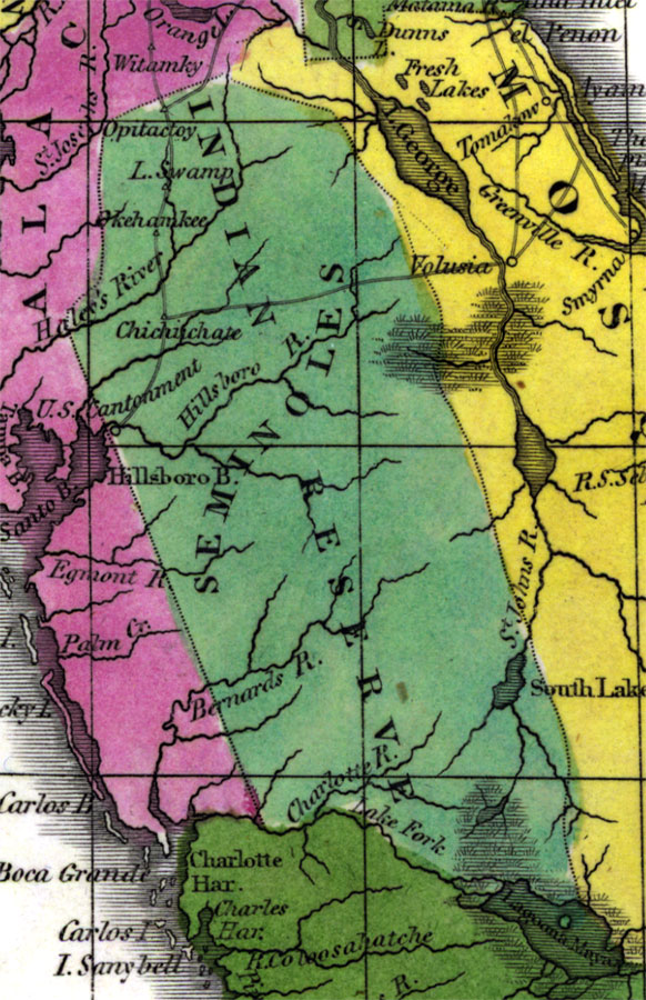
Description: Digitization provided by the USF Libraries Digitization Center. Rare Maps. This is a map of the Seminole Indian Reserve lands, circa 1834. It is a portion of a map of Florida that was originally published in William Darby's Memoir on the geography and natural and civil history of Florida. This map also shows the Seminole Indian territory which includes some of the central counties from Sumter to Highlands. It also shows towns and inland waters such as Lagoona Maya or Lake Okeechobee.
Place Names: State, Seminole, Opitactoy, Okehamkee, Hillsboro River, Hillsborough River, Lagoona Maya, Lake Okeechobee
ISO Topic Categories: inlandWaters, boundaries, transportation
Keywords: Florida Seminole Lands, physical, historical, political, transportation, physical features, county borders, railroads, inlandWaters, boundaries, transportation, Unknown,1834
Source: William Darby, Memoir on the geography and natural and civil history of Florida (Philadelphia, PA: Thomas H. Palmer, 1834)
Map Credit: Courtesy of the Special Collections Department, University of South Florida. |
|