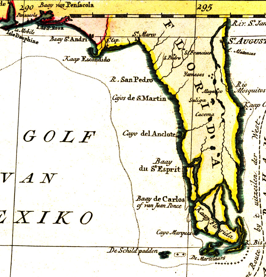
Description: A detail of Tirion's map of the West Indies showing only Florida. Digitization provided by the USF Libraries Digitization Center. Rare Maps Collection: G4900 1769 .T57 Notes from USF Library: A map of the Caribbean, also showing southern Florida, part of Yucatan and Honduras and Nicaragua. Major sea routes as well as the prevailing winds are given.Scale 1:3,000,000; (W 940--W 740/N 34030’--N 240). Measurements. Dimensions: 48 x 62 cm. on sheet 52 x 73 cm
Place Names: 1760-1779, Cape Canaveral, Saint Augustine, Pensacola
ISO Topic Categories: boundaries, inlandWaters, oceans, transportation
Keywords: Algemeene Kaart van de Westindische Eilanden, physical, political, transportation, historical, physical features, country borders, major political subdivisions, water routes, boundaries, inlandWaters, oceans, transportation, Unknown,1769
Source: Izaak Tirion , (1769)
Map Credit: Courtesy of the Special Collections Department, University of South Florida. |
|
