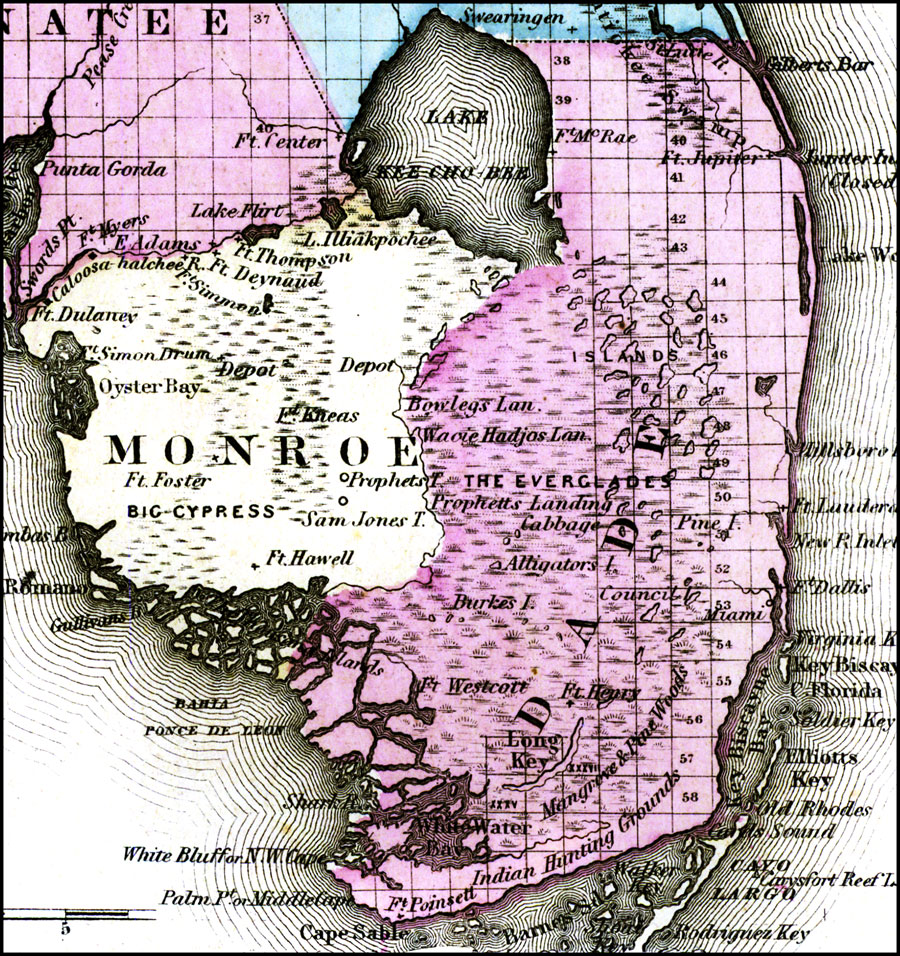
Description: A portion of Gray's map of Florida detailing the southern tip of the peninsula and the Everglades region. County lines and the township/range survey grid are shown. Note that much of the Everglades, the southern end of Lake Okeechobee, and the Monroe/Dade county line were unsurveyed at the printing of this map (1875). Forts, depots, and Native American lands are shown. Digitization provided by the USF Libraries Digitization Center. Rare Maps. This is a detailed map of Florida showing counties, cities, roads, railroads, inland waters, etc. Prime Meridians: Greenwich and Washington. Measurements. Scale ca. 1:2,600,000
Place Names: 1860-1879, Atlantic Ocean, Miami, Fort Myers, West Palm Beach, Lake Okeechobee, Fort Lauderdale, Gulf of Mexico, Indian Hunting Grounds
ISO Topic Categories: inlandWaters, oceans, boundaries, transportation
Keywords: Gray's Atlas map of Florida, physical, historical, political, statistical, physical features, county borders, ethnological, inlandWaters, oceans, boundaries, transportation, Unknown,1875
Source: Ormando Willis Gray, Gray's Atlas (Philadelphia, PA: O. W. Gray and Son, 1875) 107
Map Credit: Courtesy of the Special Collections Department, University of South Florida. |
|